Tuesday, June 27, 2006
Sunday, June 25, 2006
Being number two isn't so bad
I wanted to climb a high peak. Got a late start, so decided to climb Algonquin mountain from the ADK Loj (didn't get there until after 10:30 am). Algonquin is the second highest peak in NY (highest is Mount Marcy).
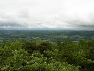
It was partly cloudy when we started hiking, but by the time we got to the summit it was mostly cloudy and grey. Not the best lighting conditions for photography.
There was a summit steward at the top (to tell everyone not to step on the fragile alpine vegetation). I asked him what all the flowers were on the way up. He said they were bunchberry.
Howie stopped in a big puddle on the summit. Drank some water and laid down for a bit. Other hikers were amused.
Summit Elevation: Algonquin Mountain 5114 ft
Round-trip Distance: 8.0 mi
Elevation Change: 3000 ft

Bunchberry
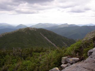
Slides on Wright peak

Mount Colden
Friday, June 16, 2006
Cat Mountain
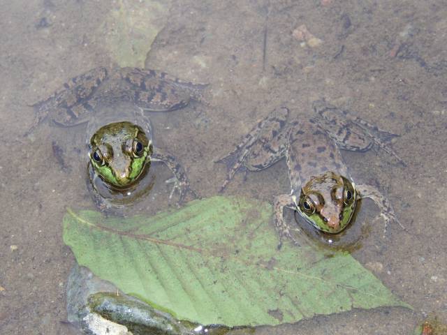
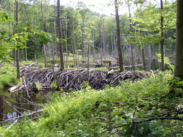
Howie and I did a hike today near Lake George. We climbed Cat mountain (...didn't see any cats, maybe Howie scared them away). The trail followed logging roads and was somewhat rocky and eroded. It passed a couple of beaver ponds and some wetlands. At the summit there is a great view to the east of Lake George and the surrounding mountains. It would be a great spot to watch the sun rise. Our trek took 3 1/4 hours on this warm, sunny and somewhat hazy afternoon. Bugs were out and ... bugging.
Summit Elevation: Cat Mountain 1956 ft
Round-trip Distance: 6.5 mi
Elevation Change: 900 ft

Ribbit ... Ribbit

Beaver dam
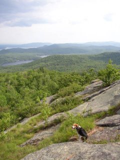
Howie on the rocky summit

Some hiking dude and his dog
Summit Elevation: Cat Mountain 1956 ft
Round-trip Distance: 6.5 mi
Elevation Change: 900 ft
Ribbit ... Ribbit
Beaver dam

Howie on the rocky summit

Some hiking dude and his dog
Sunday, June 11, 2006
Long Path
Howie and I did a hike in the northern Catskills on a section of the Long Path (Section 25). The Long Path is a long distance trail that runs from about NYC to Albany. This section brought us over three small peaks: Pisgah, Richtmeyer and Richmond. (Though, I plotted our GPS path afterwards and we never got near the summit of Richmond mountain.) The path followed a combination of old logging roads and some newer foot trails. It was somewhat confusing to follow as the trail doesn't seem to get a lot of use and and it crossed many competing wood roads. Had to be careful to follow the aqua paint markers. We didn't see anyone else in the woods on this cool, breezy, and partly sunny day. We spent about 5 hours on our trek.
Summit Elevation: Mount Pisgah 2912 ft, Richtmeyer 2980 ft, Richmond Mountain 3220 ft
Round-trip Distance: 9.0 mi
Elevation Change: 1500 ft
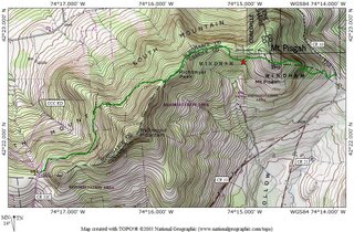
Map made using GPS and TOPO! software
Pine trees on Mount Pisgah

A partial view
Caterpillar convention
Summit Elevation: Mount Pisgah 2912 ft, Richtmeyer 2980 ft, Richmond Mountain 3220 ft
Round-trip Distance: 9.0 mi
Elevation Change: 1500 ft
Map made using GPS and TOPO! software

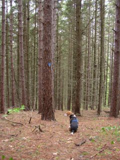
Pine trees on Mount Pisgah

A partial view

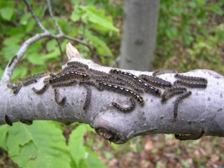
Caterpillar convention
Sunday, June 04, 2006
London like weather
Howie and I did a hike in Taconic State Park. It was wet in the woods, but luckily the rain held off for the most part. There just a few short sprinkles at times. We set off on a trail which followed along a pretty brook. It criss-crossed the brook several times. Eventually we reached Sunset Rock and then we continued on to Prospect Hill. Along the ridge, there were many blueberry shrubs, but no fruit yet. There were views from each point toward the west (Catskills), but they were limited due to the low clouds. After we returned to the parking area, we took the short trail over to Bash Bish Falls which had a very strong flow.
Summit Elevation: Sunset Rock 1788 ft, Prospect Hill 1919 ft
Round-trip Distance: 5.5 mi
Elevation Change: 1280 ft

Howie and ferns
View and clouds

Mountain Laurel
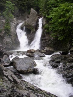
Bash Bish Falls
Summit Elevation: Sunset Rock 1788 ft, Prospect Hill 1919 ft
Round-trip Distance: 5.5 mi
Elevation Change: 1280 ft

Howie and ferns

View and clouds

Mountain Laurel

Bash Bish Falls
Subscribe to:
Posts (Atom)


