Friday, December 04, 2009

TIGF

It was a nice afternoon, so I left work early and went for some short walks. First stop was Bennet Hill. Followed the green trail up, and then the yellow loop trail around the flat top.

On the way back I stopped at a small nature preserve across from Bethlehem High School (Swift Preserve). I parked at the end of Evelyn Drive and followed all the marked trails (yellow, red and blue). It was a small forested area with some wetlands amidst houses and apartment buildings.


Sunday, November 29, 2009

Green Lakes

On the way home, I stopped at Green lakes state park near Syracuse. Did a quick two mile walk around the main lake. Trail was smooth and mostly level. Lots of other people there trying to burn off calories from stuffing and pies.
Green Lakes SP

Friday, November 27, 2009

Carpenter Falls

On Friday, I did a short hike with Howie at Carpenter Falls Ravine on the west side of Skaneateles Lake. Followed the trail all the way down to the lake and then back. Also, I checked out some unmarked side trails - one of which led down to the top of the second falls. At the upper falls, there was a special message. Covered about two miles on this cold, cloudy day.

Carpenter Falls

Saturday, November 21, 2009

Something new

After the beagle meetup this morning, I checked out some small nature preserves nearby that were new to me.

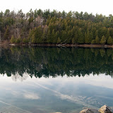
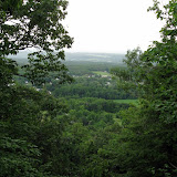
The first stop was Normanskill West preserve. Parked at the end of Normanskill Blvd (turn is off Delaware Ave near Delaware Plaza). The narrow foot path was marked with white blazes. It went down to the creek, the 2000 Delaware Ave landslide area, and then back up to the trailhead. It crossed several foot bridges along the way.

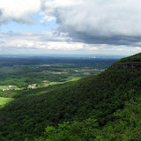
The second stop was at the Phillipinkill Preserve. Parked at the designated parking spot at the "Mansions" housing development (entrance is at Fisher Blvd off Delaware Ave). There was a short loop trail and a cross trail which bisected the loop.

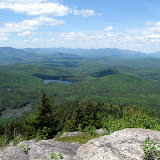
The third sstop was at Normanskill Preserve. Parked at Bagdon Environmental lot. Walked the trail down to the creek across from Stevens Farm, and then back up to the trailhead.

After the walks, Howie was unfortunately crawling with ticks.

Albany County Preserves

Sunday, November 15, 2009

Head in the clouds

I headed up north to Lake George with Howie today. We did a loop over Pilot Knob ridge. It was a cloudy day with fog on the lake. When I got to the first lookout, I couldn't see Jack ... or Jill for that matter. This wasn't a good hill to find water on anyway. I continued on the path to grassy sub-peak. I was just above the fog on the lake, but below the high clouds overhead ... kind of like the meat in a cloud sandwich. There was a brief window of clarity to the west across the lake. I took some pics and then sat down to enjoy my ham sandwich. Of course, I had to share some with Howie. I then followed the drainage back down to the main trail and then returned to the car three hours after I started.

Round-trip Distance: 5.5 mi
Elevation Change: 1460 ft

Pilot Knob Fall

Friday, November 13, 2009

Cole Hill

This afternoon, I went for a short hike with Howie at Cole Hill state forest in Albany county. Parked at the trailhead on Cole Hill Rd. Followed some forest roads in the east section. There was some loggin activity going on there. Looped back to the car and then took the Long path (aqua markers) through the central section. Passed a marsh, a beaver meadow and signs of past settlement - stone walls and an old cemetery. Continued until the quarry on Irish Hill Rd and then returned back to the car. Walked around 4-5 miles altogether.

Cole Hill SF

Monday, November 09, 2009

Crunchy leaves


I took the afternoon off and went on a short hike with Howie at Plotterkill Preserve. Parked at the trailhead on NY Route 159 and did a loop on the red trail. Howie was busy sniffing out chipmunks. Most of leaves were down which crunched underfoot. We covered about 6 miles on this warm November day.

Sunday, November 08, 2009

More trail work


I went out today to maintain the section of the Escarpment trail I adopted in the Spring. Parked at the trailhead on NY Route 23 and started out. I brought a small rake so I could clean out the diversion channels (waterbars). There was not much else to do. Cut a few downed limbs out of the way and snipped some low shrubs and branches. I continued past the lean-to (the end of my section) to the summit. It was a warm, sunny, blue-sky day. Quite a few other people on the trail (and dogs). This marks the third time I have climbed Windham this year.
Summit Elevation: Windham 3524 ft
Round-trip Distance: 6.4 mi
Elevation Change: 1740 ft

Sunday, November 01, 2009

Trail work

I went out to do some maintenance on my adopted section of trail (Mink Hollow). The trail was mostly clear. I trimmed some undergrowth along the sides of the old road. Got to the the lean-to and had a PB&J sandwich. Somewhere along the 3 mile stretch, I managed to lose my clippers.

Saturday, October 31, 2009

Trick or treat

I did a short hike this afternoon with Howie at the Huyck Preserve in Rensselaerville. Checked out the falls and then did the loop hike around the lake. Covered about 3 miles total on this warm, windy day.

Sunday, October 25, 2009

Overlook

I climbed Overlook mountain in the Catskills on this sunny afternoon with Howie. I got to the trailhead and the parking lot was full. I had to park further down the road. Needless to say, there were lot of people out on the trail. Howie kept busy sniffing out chipmunks. Fall colors were past peak but still nice.

Summit Elevation: Overlook 3150 ft
Round-trip Distance: 5.2 mi
Elevation Change: 1400 ft

Overlook (Fall)

Friday, October 23, 2009

Colour my world

I did a short walk with Howie this afternoon at Thatcher Park. It was kind of grey and blah day, but there was still plenty of Fall colors to brighten things up ... with lots of orange and yellows. Much cooler than yesterday (about 25 F degrees!).

Thatcher Fall

Saturday, October 17, 2009

Howie Day

Howie had a good day. In the morning, he went to his beagle meetup ... running around, sniffing, wrestling with his fellow hounds. This afternoon, I took him to Grafton Lakes state park. We hiked up to the fire tower (Howie stayed on terra firma) and then took the trail around Long Pond. Walked about 4-5 miles altogether.

Grafton SP

Sunday, October 11, 2009

Dog days of fall

I did a short walk with Howie and Cora near Thatcher Park. Started at the end of Ryan Road. Did a loop on various old roads and trails including part of the Long Path. We stopped for a quick break at the high point (cliff edge). Had a nice sunny, cool afternoon for our outing. Covered about 3-4 miles altogether.

OSI Preserve

Sunday, October 04, 2009

Gone to the Dogs

This afternoon, I did a short hike with Howie and his temporary roommate Cora. We climbed Bennett Hill in southern Albany County. Followed the green trail up, and then took the yellow loop trail at the top of the flattened hill. Leaves are starting to show some color (around 25%).


Friday, September 25, 2009

Nosey

I did a short hike up Vromans Nose with Howie this afternoon. The walk up the old carriageway went quickly. Soon, we were at the top of the cliffs looking down on the fertile Schoharie valley below. Perfect weather for this short jaunt ... cool with blue skies.

Summit Elevation: Vromans Nose 1240 ft
Round-trip Distance: 1.8 mi
Elevation Change: 450 ft

Vromans Nose

Sunday, September 20, 2009

Mount Never-rest

It was a nice sunny weekend. Today, I drove up to Lake George with Howie and we climbed Shelving Rock mountain. The trail was a treat for the feet as it was nicely graded old carriage road... not too many rocks to trip over. Howie spent a lot time sniffing for chipmunks. At the top, I followed the path down to the ledge with the better view.

Summit Elevation: Shelving Rock 1130 ft
Round-trip Distance: 3.4 mi
Elevation Change: 500 ft

We returned back to the car. I still felt good so I did a short loop hike down to the shore of Lake George and then back up past Shelving Rock Falls.

Shelving Rock

Sunday, September 13, 2009

Dippikill2

Went camping this weekend at Dippikill in the southern Adirondacks. Stayed in Twin Brooks cabin with Sonjoy, Manoel, and his son. Jerzy and his wife stayed in Foxlair cabin. The weather was not the best (cloudy with on and off light rain showers), but we still had fun. There was no shortage of good food - especially meat. Did a short hike on Saturday to Dippikill pond, which was about a mile from our cabin.

Dippikill

Wednesday, September 09, 2009

On the mend


I went for a short walk after work at Thatcher Park with Howie. We followed the Indian Ladder trail. Spent about half an hour at the park.


Monday, August 17, 2009

Friday, July 10, 2009

Cascade and Porter

It looked to be a nice day (no rain!). So, I decided to take the day off and head north with Howie for a hike. We climbed Cascade and Porter mountains from Route 73. They are two of the easier Adirondack high peaks to climb. We had lots of company on this hike, as there were many other hikers on the trail ... including a handful of dogs. The trail was a bit wet and muddy, but not the worse I have seen. The bugs came out in the afternoon ... they must have been sleeping in.

Summit Elevation: Cascade 4098 ft, Porter 4059 ft
Round-trip Distance: 6.2 mi
Elevation Change: 2360 ft

Cascade and Porter

Monday, July 06, 2009

AT

Over the fourth of July weekend, I hiked part of the Appalachian Trail in Shenandoah National Park with my sister. On Friday morning, we started out from the Lewis mountain campground. We head north, taking a side trip on the Bearfence trail. It was a bit of a scramble on the rocks, but there were nice views to be had. We continued on over Hazletop mountain and then down to Milam Gap. We ended the day at Big Meadows lodge where we stayed the night. The next day we continued on the AT past Franklin Cliffs. I caught a glimpse of a bear up on side of the trail. I took the Salamander trail up to Hawksbill mountain and then down the lower Hawksbill trail. Anne continued on the AT and met me on the other side. We ended the day at Skyland lodge where we stayed the night. The following morning, the weather was less than perfect. It was raining lightly, but we continued on anyway. Unfortunately, it never stopped sprinkling and got foggier as the day progressed. We went over Little Stony man and then up Pinnacle mountain. On the other side of Pinnacle, was a shelter where we stopped for a bit. We continued on past Mary's Rock and then down, down, down to Thornton Gap. Tom was nice enough to drop us off and pick us up. All together, my sister and I hiked 26+ miles over three days.
Shenandoah

Sunday, June 14, 2009

Trail work

I climbed Windham High Peak in the Catskills today. I also worked on my newly adopted section of the trail ... the first 1.1 miles of the Escarpment trail from the trailhead on Route 23 to the lean-to. For the most part, the trail was in good shape. A crew had gone through already and cleared the blowdown. I clipped a few branches here and there, but there was not much to do. After taking a break at the lean-to, I continued climbing to the top.

Reached the summit, enjoyed the views and some snacks. Real nice day out.

Summit Elevation: Windham 3524 ft
Round-trip Distance: 6.4 mi
Elevation Change: 1740 ft

Windham 2

Saturday, June 13, 2009

Unsettled

The weather forecast look a bit unsettled, so I just did some quick hikes this afternoon in southern Albany county. The first was at Bennett Hill Preserve. Howie and I started out on the trail alongside the cow pasture to the back of the preserve and up to the middle plateau. Then, we took the newer red trail to the top of the hill. There was a new "manufactured" view at the northern end of the loop trail. After circling the top, we headed back down to the car.

Next, we stopped at Lawson Lake county park. Walked on the loop trail that lead to a small creek. Then we checked out the lake briefly. There were some brief, light showers at times during our walks, but no real rain.

Bennett Hill

Friday, June 12, 2009

Good dog

I took Howie to the vet this afternoon. After getting poked, prodded and a clean bill of health, we headed up to Thatcher Park for a short hike. A brief shower had just passed by, so everything was wet. But, luckily it didn't rain while we were there. Spent about an hour walking around including the Indian Ladder trail.

Thatcher Park 2

Saturday, June 06, 2009

Snowy

I hiked Snowy mountain in the Central Adirondacks with Howie. The first couple miles were nice and easy. The last mile was steep and the trail badly eroded in spots. Also, the bugs increased in number and verocity as I climbed. At the top, a cool breeze kept most of the buggers away. Nice views from the tower and also the ledges near the summit. Howie enjoyed about half my turkey sandwich.

Summit Elevation: Snowy 3899 ft
Round-trip Distance: 7.5 mi
Elevation Change: 2200 ft
Snowy

Friday, June 05, 2009

Chip and Dale

I did a short hike this afternoon at Plotterkill Preserve. Did a loop on the red trail. Howie kept himself busy chasing chipmunks which were very numerous in the woods. Instead of crossing the Plotterkill a second time and back up to the ridge, I opted to just follow along the creek bed for a while. The water was low and there were paths in places on one side or the other. Reached a cascading waterfall and then the base of the lower falls. Scrambled up and on to the base of the upper falls. Then, I headed back up to the ridge trail and out. A nice day for a walk even though it was cloudy. Walked about 6 miles or so.

Plotterkill 2

Monday, June 01, 2009

Devil Dog

I climbed Plateau mountain in the Catskills today. I did a loop starting on Notch Inn Road. Walked up the gravel road to the start of the new Warner creek trail. There were a lot of switchbacks in the new trail to moderate the climb. Passed several viewpoints on the way up. The last two on the new trail had the best views. Stopped at a spring so Howie could get some water. Continued on to the junction with the Devils Path. Turned right and followed the path over the true summit of Plateau and on to the eastern viewpoint. Had a quick snack break and then head over the long flat ridge (around 2 miles) to the opposite end. Met one couple on the way. The guy dubbed Howie "Cujo". I stopped at the western view point for another break before heading back down the steep trail to Notch Lake. Followed the highway back down to my parked car. A nice sunny day for a hike.

Summit Elevation: Plateau 3850 ft
Round-trip Distance: 8.2 mi
Elevation Change: 2450 ft

Plateau

Monday, May 25, 2009

Hike like an Egyptian

I climbed Pharaoh mountain in the Adirondacks today with Howie. From the trailhead on Route 74, I took the Long Swing trail (Blue Hill trail) to Crane pond and then continued on the red-marked trail to the summit. There were not too many people out in the woods. There were a lot of mosquitos though ... the nasty kind that would find the one place you didn't put bug repellent. At the top, cool breezes and lots of sunshine.

Summit Elevation: Pharaoh 2556 ft
Round-trip Distance: 12.0 mi
Elevation Change: 1860 ft

Pharaoh

Friday, May 22, 2009

PK 2


I took the afternoon off and headed up to Lake George with Howie. We did a loop over Pilot Knob following the "marked" path to the grassy sub-peak, and then followed the drainage back down to the main trail.

I also checked out Stewarts Ledge which is an overlook on the NW shoulder of Pilot Knob. I wasn't sure where the trail started. I followed one obvious path which lead up to the ledges and past some overlooks. Another path lead back down below the cliffs and back out to main trail.

Round-trip Distance: 5.5 mi
Elevation Change: 1460 ft

Friday, May 15, 2009

It's gonna be huge!

or Giant in this case ... which is the mountain I climbed today with Howie. It's one of the easier climbs in the Adirondack high peaks. Conditions were very good: weather-wise (cool and sunny with a breeze), trail-wise (just a little wet and muddy in spots), bugs-wise (apparently taking the day off). There was a little of snow left in spots near the top, but most of it had melted. Seemed like I was twice as old as everyone else on the trail today. Don't know if that's good or bad. In any case, had a great day on the trail.

Summit Elevation: Giant 4627 ft
Round-trip Distance: 6.0 mi
Elevation Change: 3050 ft
Giant

Sunday, May 10, 2009

Berlin

I did a hike in the Taconics with Howie this afternoon. Climbed Berlin mountain from Southeast Hollow. Followed the trail (an old logging road) up to the ridge, and then took the Taconic Crest trail north over several bumps. It was very windy out. We saw a turkey (I think) walking on the trail. It took to flight as we got closer. Reached the grassy summit and took a few pics. It was a bit cool and windy on top, so I didn't linger too long. As I headed back, the skies cleared out and the sun was shining. Only saw three other people in woods today.

Summit Elevation: Berlin 2798
Round-trip Distance: 8.4 mi
Elevation Change: 2100 ft

Berlin mountain

Saturday, May 09, 2009

Trail U

I took Trail Maintenance 101 class today at North-South Lake campground (Catskills). The first part was oral instruction on how to do trail maintainance. The second part was field work on a short section of the Escarpment trail (using loppers and pruners). Covered pretty basic stuff that I mostly knew. Also, I adopted another short section of trail.

Friday, May 08, 2009

If you don't like the weather, just wait...

I did a short hike/walk with Howie this afternoon. We visited the Huyck Preserve in Rensselaerville. Took in the main waterfall and then followed the trail around Lake Myosotis. A couple of guys were fishing along the edge of the lake. The weather started out cloudy with some very light drizzle, but then the clouds cleared out and the sun was shining brightly. Got home and planted flowers.


Saturday, May 02, 2009

Meow

I did an easy hike near Lake George with Howie. From the trailhead, we started out on an old logging road. If you stopped for too long, the bugs would start swarming around you. It motivated me to keep moving. Reached the top of Cat where there nice views of the lake and surrounding mountains. Had a quick lunch, took some pics and then followed the relatively new ridge trail over to Thomas mountain. A porcupine ran up a tree and waited for us to pass. Went over some small bumps along the ridge and then made the final ascent of Thomas mountain. A small cabin is located at the top near a rock ledge. Followed another road back down and then out to the car. Much sunnier out than forecast.

Summit Elevation: Cat 1956
Round-trip Distance: 7.0 mi
Elevation Change: 1600 ft

Cat and Thomas

Saturday, April 25, 2009

Fast forward to summer

It was forecast to be a hot, sunny day. So, I opted to just do a short walk with Howie at Thatcher Park. It was odd to see the huge snow/ice formations under the waterfalls ... considering that it was around 85 degrees out. Walked about 3 miles altogether on the Indian Ladder Trail and along the escarpment.

Thatcher Park

Friday, April 24, 2009

Plotterkill

I left work a little early and did a short hike with Howie. We went to Plotterkill Preserve and did a loop hike on the red trail. The water in the creek was pretty low due to the lack of "April showers". Instead of crossing the creek a second time, I bushwacked up the slope near the eroded hillside. At the top of the south rim, I found an unmarked trail that lead back to the overlook trail. Walked about 6 miles altogether on this sunny, warm afternoon.

Plotterkill

Friday, April 17, 2009

Tongue

It was too nice a day to work, so I went hiking with Howie instead. We did a loop over the Tongue mountain range near Lake George. Took the ridge trail over Fifth Peak, French mountain and First Peak and then returned by the trail along Northwest bay. I waded my feet in the Lake, but it was very cold. It was sunny, warm and breezy all day - perfect for hiking.

Summit Elevation: Fifth Peak 1813 ft, French mountain 1756 ft, First Peak 1586 ft
Round-trip Distance: 12.0 mi
Elevation Change: 2800 ft

Tongue

Friday, April 10, 2009

Got coupons?

I took the afternoon off and did a hike with Howie. We hiked the Taconic Crest trail starting at Petersburg Pass on Route 2. The woods were mostly snow free except for a few patches here and there. The trail was a bit muddy in spots, but not terrible. We hiked passed the two view points (White Rocks) and then stopped at the Snow Hole - a crevice in the ground that holds snow well past Spring. Had some snacks and I put on my jacket. I realized I had a bunch of unused coupons in my pocket. There was no store in sight, so I returned to hiking back to the car. The 5-6 mile trek took around 2 1/2 hours.

Snow Hole

Friday, March 27, 2009

Peek-a-boo

I took the day off and did a hike with Howie in the Catskills. Started from the trailhead on Peekamoose road. Climbed up the blue marked trail through a mostly deciduous forest. The sun shone brightly through the leafless trees. Reached the balancing rock (reconnoiter rock), and started to see snow. It got deeper as I ascended, but it was packed down. I didn't sink in too much, though it made progress somewhat slower. Reached the viewpoint at around 3500 feet and took a much needed break. After snacks and photos, I continued on to the real summit. Not much to see there as it is densely covered with confiers. Returned back to the start. It was another warm day out ... didn't even need a jacket most of the time. Saw nobody else in woods.

Summit Elevation: Peekamoose 3843 ft
Round-trip Distance: 6.7 mi
Elevation Change: 2630 ft

Peekamoose

Saturday, March 21, 2009

Alander

The nice March weather continues. Did a hike with Howie in the Taconic hills. We climbed Alander mountain from Under mountain road. Followed the Robert Brook trail up to the ridge, and then continued on the South Taconic trail to the summit. It was very sunny with a cool breeze. The woods were almost snow free, except in sheltered areas and on shady northern slopes. There was one large group at the top, but otherwise didn't see too many people out on the trail.

Summit Elevation: Alander 2250 ft
Round-trip Distance: 5.0 mi
Elevation Change: 1500 ft

Afterwards, I did a quick walk at nearby Bashbish Falls and also at High Falls in Philmont.

Alander (Spring)

Saturday, March 14, 2009

Ashokan High Point

I did a hike with Howie today in the Catskills. We climbed Ashokan High Point from Peekamoose road. The trail first follows along Kanape Brook on an old road. There was very little snow or ice left. The trail then turns left and climbs steadily to the summit which was once a fire tower site. The views were a bit hazy to the south. Continued on the loop trail and then back down to the car.

Summit Elevation: Ashokan High Point 3080 ft
Round-trip Distance: 8.0 mi
Elevation Change: 2000 ft

Ashokan High Point

Saturday, March 07, 2009

Pilot Knob

I went on a short hike near Lake George climbing Pilot Knob. There were mixed conditions in the woods with bare spots, ice, hard packed snow and soft snow. A little tricky down low with the icy spots. But, I used Stabilicers which helped a lot with traction. Howie had to make do with four-paw drive. Got to the sub-peak and stopped for a lunch break. It had clouded up considerably since the start of the hike. Headed back down and made it out safely. Howie met a beagle mix in the parking lot.

Round-trip Distance: 4.5 mi
Elevation Change: 1500 ft

Pilot Knob

Saturday, February 07, 2009

Gone with the Wind(ham)

Howie and I did a hike in the Catskills today. When I woke up, it was 13 degrees out. By the time I got to the trailhead on Route 23, it was 38 degrees out! What a difference a few hours makes. Started out on the trail, and it was packed powder snow. Didn't wear snowshoes ... just carried them on my back all day. Howie met another beagle (named Bagel). Stopped at the lean-to for a snack and to remove some layers (I was getting warm). Continued on under bright sunshine. Made it to the top where we stopped for more snacks and photos. It was a nice hike today with all the sunshine ... which was a bonus as the forecast called for mostly cloudy skies.

Summit Elevation: Windham 3524 ft
Round-trip Distance: 6.4 mi
Elevation Change: 1740 ft

Windham High Peak

Monday, January 19, 2009

Moreau

I did a hike today at Moreau State Park with Howie. I used snowshoes most of the day. The snow was about a foot deep, but it was mostly already packed down by earlier travelers. There was one section on the return leg (about 3/4 mile long) which was virgin snow. It was tough going breaking trail. Howie actually followed behind me on this part as the snow was nearly as deep as he is high. We covered a lot of ground today ... visited the Moreau overlook plus several view points along the western ridge above the Hudson river. It was nice to get out after all the frigid weather we have been having.

Round-trip Distance: 8.0 mi
Elevation Change: 900 ft

Moreau

Sunday, January 11, 2009

Fresh snow

I went snowshoeing over at the Albany Pine Bush with Howie. Parked at the Discovery center lot and did a loop hike. There was about 6 inches of fresh snow from the storm last night. Our stroll took about an hour (around 2 miles).

Pine Bush

Sunday, January 04, 2009

Results driven hike

I did a hike on this sunny day with Howie in the Catskills. We climbed Overlook mountain from Mead mountain road. The snow on the jeep road was well packed down, so the going was easy with just boots. Made it the top, climbed the tower for some pics and then headed over to the rock ledge. Had lunch, soaked in some sun and then walked back down. On the way, I overheard a conversation ... "You're not following the results driven formula..." What a tool. Anyway, had a nice easy hike to start out the new year.

Summit Elevation: Overlook 3150 ft
Round-trip Distance: 5.2 mi
Elevation Change: 1400 ft

Overlook