Tuesday, March 31, 2015

Cobble Hill

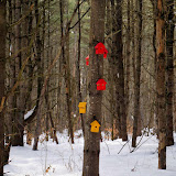
Took a day off from work and climbed a small hill in the central Adirondacks. Followed the snow plow truck the last couple miles to the turn-around on Loch Muller road. Parked near here since the remaining 0.25 miles to the trailhead was not plowed. There was only about an inch of fresh snow - and at least a foot of old snow. Grabbed my pack, donned my snowshoes and continued walking up the road to the trailhead. At the first trail junction, turned left onto the Bailey pond trail. Followed the foot path for about 0.25 miles where it turned right onto an old road. I left the trail near this point and headed up toward the top of Cobble Hill. It was easy going as the mostly deciduous woods was very open, and the snow was still quite supportive. I quickly reached the highest point and then took in the nice views from ledges just south of the top. It had warmed up with the bright sunshine, and the snow was starting to clump up on my snowshoe crampons. After a snack, I continued down toward Bailey pond. Crossed the pond and then picked up the trail again.  Followed the trail back to the car. A nice "Spring" day for a short trek in the woods.

Summit Elevation: Cobble Hill 2234 ft
Round-trip Distance: 4.5 mi
Elevation Change: 580 ft
Cobble Hill

Sunday, March 29, 2015

Mount Blue

I read an online trip report that someone had climbed Mount Blue in the Adirondacks on Saturday. So, I went out today to try and follow their tracks. I parked at the trailhead on Garnet Lake. Walked across the frozen lake to the shore on the southwest side - and the start of the snowmobile trail that leads to Lizard Pond and beyond. Followed the trail until almost the height of land, then veered off and followed the snowshoe tracks up. Much easier climbing when someone else does the trail breaking for you! Reached a lower viewpoint and then continued up the southern ridge to the large open area. Eventually I reached the summit and headed back down. Stopped at the open area and had a snack. Felt warm with the suns rays beaming down on me. Saw a lone snowmobile crossing the lake as I was returning. Beautiful day for hiking.

Summit Elevation: Mount Blue 2925 ft
Round-trip Distance: 5.5 mi
Elevation Change: 1470 ft
Mount Blue

Friday, March 27, 2015

STEP right up

Did a short walk late this afternoon with Benny in Malta. Visited the STEP (Saratoga Technology Energy Park) woods at Luther Forest. Parked at the trailhead lot on Hermes Road. Did a loop using various trails, including some of the main trails that are shown on the map (and marked with white disks)- plus some mountain biking trails that tended to meander through the woods. Trails are still covered with mushy snow and ice.
STEP trails

Tuesday, March 24, 2015

Kibby Pond overlook

Went for a short snowshoe hike in the central Adirondacks today. I climbed an un-named hill east of Kibby pond. There are cliffs along its western face and I thought there might be some views if I could reach them. I started from the other side on Bartman road. I drove to the end that is maintained in the winter, and parked near the little red school house (camp). I hoofed the remaining 1/4 mile along the road until just before the snowmobile parking area. I could have driven this stretch, but it was icy under the light coating of snow. I veered right onto a jeep road. It was easy walking as snowmobiles had packed the snow down. After 3/4 mile, I reached the state land boundary and another camp ("camp chippewa"). I took a bearing and headed NW uphill toward the summit. It was primo snow shoeing conditions. The snow had a nice crust and was very supportive. The only problem was that the snow had a tendency to clump up and stick to the front and back crampons on my snowshoes. Had to stop periodically and bang the snow off. The woods were open deciduous and I made good time until I reached the peak. I dropped down the west side to make my way to the cliffs. This is where things got gnarly with a lot of thick spruce and steep slopes and ledges. I wandered around fighting my way through the trees. Managed to get some decent views from one set of cliffs SW of the top. Went back the way I came. Beautiful day with mostly sunny skies and no wind.

Summit Elevation: no name 2765 ft
Round-trip Distance: 4.0 mi
Elevation Change: 950 ft
Kibby Pond overlook

Saturday, March 21, 2015

Catskill Ramble

Did a couple of easy walks with Benny near the village of Catskill. First, we went to the RamsHorn-Livingston Sanctuary. Followed the entrance road in, and then did a clockwise loop around the perimeter trails in the wooded area (blue, white and red). The trails were slippery in spots, with fresh coating of snow covering ice. Seems to be a popular spot for dog walkers - Benny met about half dozen other canines.

Next stop was just a few miles north at the Cohotate Preserve. Did a loop and covered all the trails here.

Altogether, we walked about 3.5 miles on the first day of Spring. The day started out sunny, but clouded up. Luckily it never rained.
Catskill

Sunday, March 15, 2015

Moccasin Kill

Went for a short hike with Benny at Moccasin Kill Preserve near Rotterdam. Followed the blue loop trail and part of the red trail. Still plenty of snow up in the hills.

Friday, March 13, 2015

Wolf Pond Mountain

Went for a snowshoe hike in the southern Adirondacks today. I climbed Wolf Pond mountain in the Wilcox Lake Wild Forest. Parked at the beginning of Mud Pond road off Garnet Lake Road. Donned my snowshoes and headed up the unplowed road. There was a crust on top of the deep snow, but you would still sink a bit with each step. Took a short side trip to Mud Pond and then continued until the summer parking area. I made a wrong turn and followed a woods road heading north. It lead to a spring house. I corrected myself and found the correct trail that lead west toward Round Pond. Upon reaching the pond, I made my way around the east side of it, crossed a swampy area (luckily still frozen), and then headed up the peak. The woods were pretty open. There was some blowdown, but a lot of it was buried under all the snow. At first, the snow was very supportive and I wouldn't break through the upper crust too much. About 1/3 the way up though, I was sinking up almost to my knees. It was slow going for quite a while as I climbed the steep hillside. Had to zig zag back and forth across the slope to make it somewhat easier. I eventually reached a level area with a huge boulder. There were also nice views (mostly to the west) from some open ledgy areas here. I continued on to the summit. It was a bit easier at this point as the snow was more supportive again. Backtracked the way I came. The snow was softening up a bit in the late afternoon, and I was sinking deeper than I had in the morning. Finally reached the car. A tiring but satisfying day in the woods.

Summit Elevation: Wolf Pond Mountain 2576 ft
Round-trip Distance: 6.0 mi
Elevation Change: 980 ft


Wolf Pond Mtn

Saturday, March 07, 2015

Skid Row

Did some easy hiking with Benny today near Saratoga. First stop was the North Woods trails at Skidmore College. Parked in the Falstaff's lot. Did a counter-clockwise loop using the perimeter trails (red, blue and orange). Easy walking on packed trails. Some small hills to climb on this two mile trek in the woods.

Next stop was Rowland Hollow Creek Preserve - a small nature preserve tucked in next to a housing development. Parked in the lot on Grand Ave. Followed both the white and red loop trails. Walked another mile.
Skidmore