Sunday, December 04, 2005

It's beginning to look a lot like Christmas

Howie and I went on short hike today with a friend and their dog in Plotterkill Preserve near Rotterdam. It had just stopped snowing (about an inch of new snow). So all the branches were covered with snow. The creek was partially frozen over which made the falls prettier. Though, it's hard to photograph the three main waterfalls.
We did a loop hike on the red trail - taking the yellow side trail to the ladder falls at the Thruway end and another yellow trail down to the second falls. It was about a three hour hike.


Ladder falls

Sunday, November 20, 2005

Hun-tah

Howie and I hiked up Hunter mountain in the Catskills. There is a ski resort on the north side. We climbed it from the west (Spruceton road) doing a loop (Diamond Notch trail => Devil's Path => Hunter trail => Spruceton trail).
We had a nice sunny day for our afternoon hike. There was a dusting of snow and some icy spots near the top.

Summit Elevation: Hunter 4040 ft
Round-trip Distance: 7.9
Elevation Change: 1950 ft


Fire Tower


View point near top


Spring

Saturday, November 12, 2005

Wittenberg

Howie and I hiked up Wittenberg mountain with a friend and their dog. We had good weather for this hike. The peak is near Cornell (the mountain, not the school). We met some UPS guys on top - but they weren't wearing brown ... They had good sandwiches though.

Summit Elevation: Wittenberg 3780 ft
Round-trip Distance: 7.8
Elevation Change: 2500 ft


Saturday, November 05, 2005

Off the beaten path

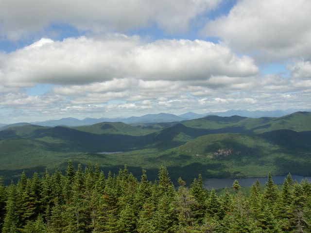
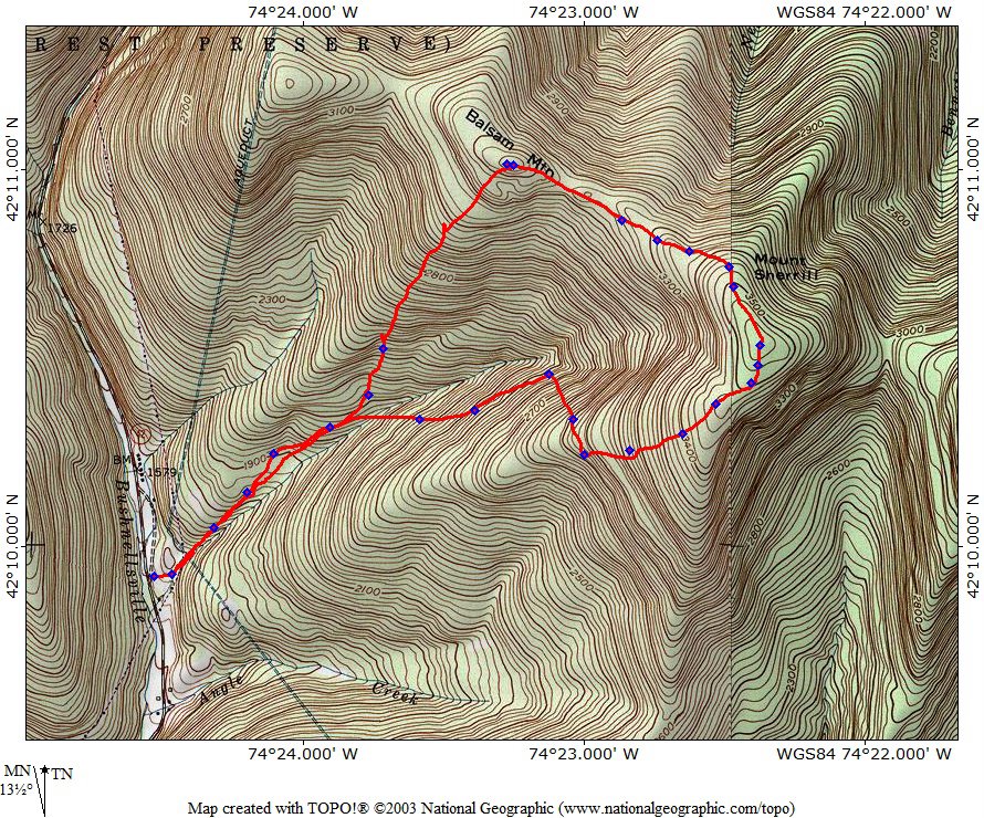
Howie and I hiked up Sherrill mountain in the Catskill mountains. There was no trail to the summit, so I used my GPS to navigate. It was open woods for the most part.
Near the top, we saw a deer that froze in his tracks when he spotted us. Tried to get closer for a better photo, but he took off down the mountain.
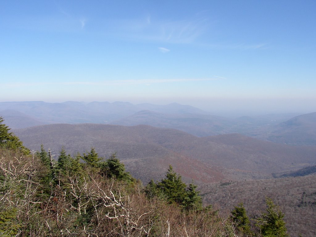
Got to top, found the Catskill 3500 cannister and signed in. There were no views to be had on the wooded summit.
Next, we followed the ridge over to Balsam - just a small bump and another non-descript Catskill peak. After a quick break, headed back down to the parking area.
Didn't see anyone else in the woods on this warm, partly sunny day. This approx. 5 mile walk in the woods tooks us around 5 hours (longer than usual but we were off-trail). There were only a few traces of snow left in the woods.

Summit Elevation: Sherrill 3540 ft, Balsam ~3345
Round-trip Distance: 5.0
Elevation Change: 2100 ft


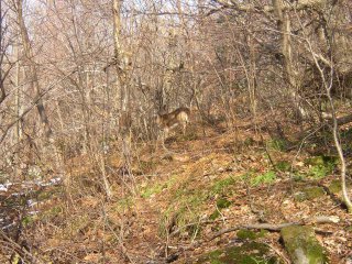
Can you spot the deer?


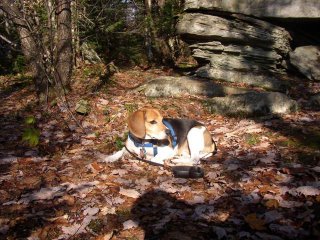
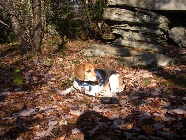
Howie napping on Sherrill mountain


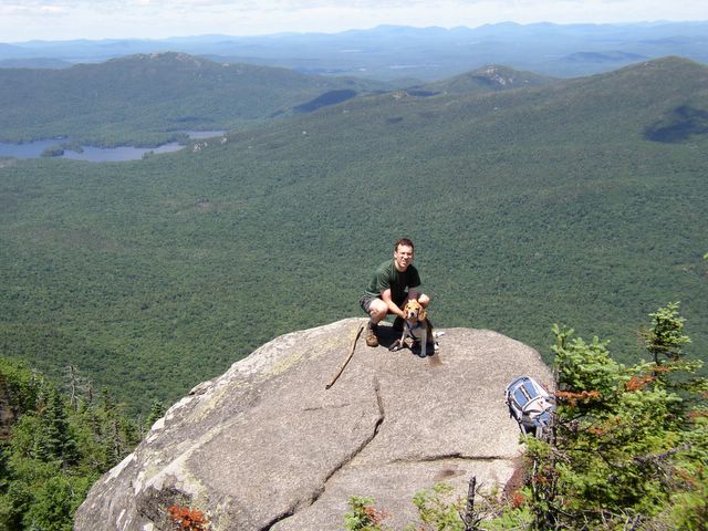
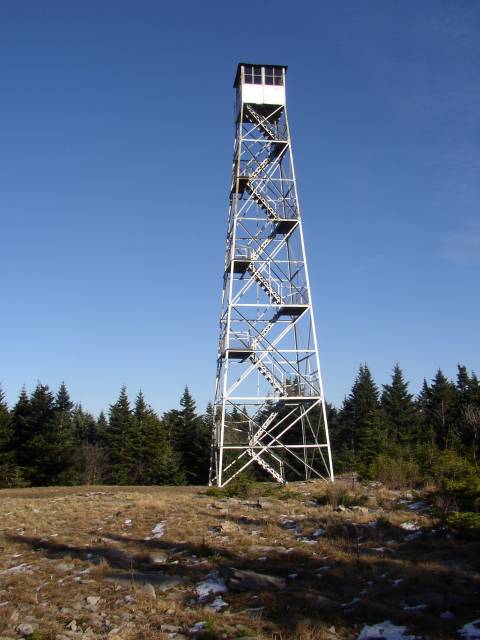
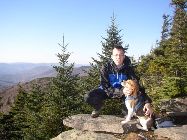
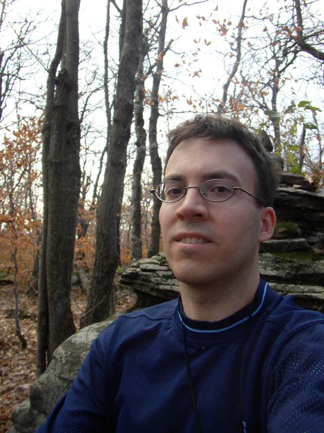
Self-portrait on Balsam
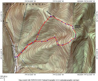


The route we took

Sunday, October 30, 2005

Porky

Howie and I went on hike in the Catkill mountains today. We climbed Blackhead mountain from Storks Nest Road.
The start of the hike followed an old carriage road up to a notch. There were still some leaves on the trees down in the valley.
Stopped for a quick break in the notch, then continued on up the Escarpment trail. Coming down the trail, we saw a porcupine! It got within two feet of us. It was first time I ever saw one. Howie wanted to get a closer look, but I wouldn't let him.
Futher up on the ridge, the snow got deeper - about 12 inches or so. It was mushy snow, and I didn't have my snowshoes. Made for a very tiring ascent.
We made it to the top and then quickly came back down.
The porcupine was the only mammal we saw this day. Got back to the car six hours after we started.

Summit Elevation: Blackhead 3940 ft
Round-trip Distance: 9.4 mi
Elevation Change: 2800 ft


Friday, October 21, 2005

Finally!

We finally had a break from cloudy, windy and rainy weather. So, I took a day off from work and went hiking!
Howie and I climbed Porter and Cascade mountains in the Adirondack High Peaks from the Garden trailhead.

The fall colors were past peak, but there were still lots of yellows in the lower valley. Near the top of the mountains there was a dusting of snow. We had a picture perfect day for our trek which took us a little over 6 hours.

Summit Elevation: Porter 4059 ft, Cascade 4098
Round-trip Distance: 10.0 mi
Elevation Change: 3100 ft


Big Slide from Little Porter


On Porter mountain


View from Cascade

Saturday, October 01, 2005

Mission Accomplished!

Today, I hiked Sawteeth mountain in Adirondacks with Todd and Mengis from work. (Howie couldn't go because of AMR restrictions - no dogs).
This was a momentous occasion as it was my 46th high peak - thus making me an Adirondack 46er. Woohoo!
We had a picture perfect day for this event. Some Fall colors, but not peak yet.

Summit Elevation: Sawteeth 4100 ft,
Round-trip Distance: 13.0 mi
Elevation Change: 2800 ft


Me on the summit


Rainbow Falls

Friday, September 30, 2005

Quick Hike

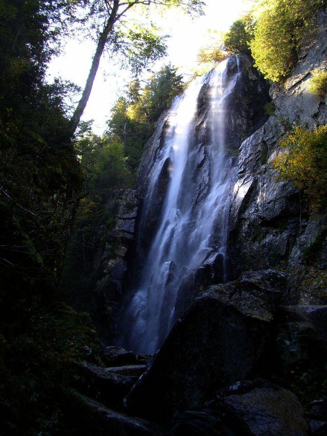
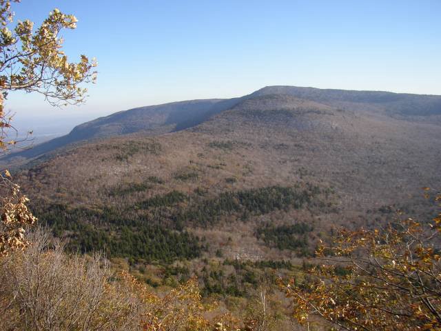
Howie and I hiked around Thatcher Park this afternoon. Took the Indian Ladder Trail and walked along the Escarpment trail. Spent almost an hour there. The creeks were dry. Leaves are just beginning to change color.

Saturday, September 10, 2005

Heh..heh..heh

Today, I hiked Colvin and Blake mountains in the Adirondack high peaks. I couldn't bring Howie, as dogs are not allowed on AMR property. Boooo!
It was a perfect September day. Cool and sunny. From Colvin, you could see the slide on Nippletop. (Heh...heh...heh... Sorry, the name makes most guys snicker.)

Anyway, the trek took about 7 1/4 hours at a quick pace.

Summit Elevation: Colvin 4085 ft, Blake 3980 ft
Round-trip Distance: 14.5 mi
Elevation Change: 4000 ft


Great Range


Nippletop

Monday, September 05, 2005

Red Alert!

Wanted to do an easy hike close by - so Howie and I went to Moreau State Park near Glens Falls. Parked at trailhead at top of hill on Spier Falls Road. We did a loop consisting of the Western Ridge (yellow), Eastern Ridge (blue), Ridge Run (Red), Overlook (Light blue), and Turkey (white) trails. Altogether, it was around a 7 mile trek with lots of ups and downs.
When we stopped at the overlook (high) above the dam, an alarm started going off. Then I heard water running. They were just releasing some water - so no real crisis.
All in all, it was a nice hike in a park I hadn't been to before.


Best "dam" view


Another view point


A map I made with using GPS and TOPO! software

Friday, September 02, 2005

A Trickle Runs Through It

I took the afternoon off and went hiking with Howie. We went to Plotterkill Preserve in Schenectady County. Hiked the red trail (loop trail), plus one yellow spur trail that I hadn't been on before. Spent about three hours there - and didn't see a sinlge person. There wasn't much water running though - so the falls weren't too spectacular. But, it was nice to be out and away from work and such.


Small cascade

Saturday, August 27, 2005

Howie is famous

Howie and I hiked Basin and Saddleback mountains in the Adirondack high peaks. It was a strenuous hike with some steep climbs. A group that we passed recognized us from our hike a few weeks ago up Cliff and Redfield (mainly because of Howie). They were doing the same hike as well (what a coincidence!). We had a sunny day with blue skies for this trek which took us a little under 10 hours.

Summit Elevation: Basin 4824 ft, Saddleback 4526 ft
Round-trip Distance: 16.5 mi
Elevation Change: 4000 ft


Looking at Saddleback and rest of Range from Basin


Howie on Saddleback (with Basin in background)

Thursday, August 18, 2005

Bubble Boy

Another hike we did in Acadia National Park was South Bubble. It was an easy climb to the summit from the parking area. There was a large boulder just below the top, Bubble Rock, which is a glacial erratic. The hike back down to Jordan pond was very steep and rocky - much better to ascend this way than to descend.

Summit Elevation: South Bubble 766 ft
Round-trip Distance: ~2.0 mi
Elevation Change: 500 ft


On the summit with North Bubble in the background

Tuesday, August 16, 2005

Watch your step

I took a trip to Maine with my sister. We visited Acadia National Park. On the first day, Acadia mountain was our destination. It was a short climb up to the summit from the trailhead. There were good views from the rocky summit. The hike down the other side toward Somes Sound was steeper and my sister twisted her ankle. We returned via the fire road.

Summit Elevation: Acadia 655 ft
Round-trip Distance: ~3.0 mi
Elevation Change: 600 ft


On the Summit

Saturday, August 06, 2005

Hello ..... Hello again

Howie and I hiked Cliff and Redfield mountains in the Adirondack high peaks. It was another tough day hike.

Started at the Upper Works trailhead around 7:45 AM. Took the Calamity Brook trail to Flowed Lands and then the trail to Lake Arnold. From there, we followed Opalescent trail to Uphill Lean-to and the start of the two herd paths. On the routes to the two summits, we kept bumping into the same groups of people. Many people were impressed with Howie's hiking ability - though he had a little trouble negotiating the steep rock ledges on Cliff.

We arrived back at the car around 7:30 PM - nearly 12 hours of hiking (including rests). A picture perfect day for hiking.

Summit Elevations: Cliff 3960 ft, Redfield 4606 ft
Round-trip Distance: 19 mi
Elevation Change: 3600+ ft


Mount Colden reflecting on Lake Arnold


Proof that I climbed Cliff


View from Uphill Brook


View from Redfield

Saturday, July 23, 2005

Butt-kicking Hike

Todd from work and I (along with Howie) hiked the Seward range in the Adirondacks (near Saranac Lake). It was tough hike for sure.

On Friday, we camped out near the trailhead - Todd in his tent, and Howie and me in the back of the Vibe. We were on the trail the next morning by 6:30 AM. Took the Caulkins brook herd path up to the ridge. Stopped at the two view points on Donaldson. Then, we bagged Emmons. Had to backtrack over Donaldson and then climbed up and over Seward. Made it back to the car 11 hours after we started. The weather was perfect for this hike.

Summit Elevations: Seward 4361 ft, Donaldson 4140 ft, Emmons 4040 ft
Round-trip Distance: 16 mi
Elevation Change: 3700 ft


Looking east from Donaldson


Seward from Donaldson

Thursday, July 21, 2005

Howling at the moon

This evening, Howie and I did a hike up Overlook mountain in the Catskills. We watched the sun set, and then waited for the moon to rise. Hiked down the road in the dark. Didn't need to use my flash light as the full moon provided enough light.

Summit Elevation: 3150 ft
Round-trip Distance: 5.2 mi
Elevation Change: 1400 ft


Red moon rising


Sunset

Saturday, July 02, 2005

Seymour Butts

Today I hiked Seymour mountain with Todd from work (and Howie).

Summit Elevation: 4090 ft
Round-trip Distance: 14.0 mi
Elevation Change: 2000 ft

Seymour, located near Saranac Lakes, is one of the Adirondack high peaks. The 5.5 mile approach was relatively flat and easy walking, while the final 1.5 miles were steep and slow going. We had a picture perfect day for hiking.


Northern lookout on Seymour


Seward range from Seymour

Sunday, June 19, 2005

Double your (hiking) pleasure

Howie and I climbed two more peaks with fire towers on Sunday.

Goodnow Mountain

Summit Elevation: 2690 ft
Round-trip Distance: 3.8 mi
Elevation Change: 1040 ft

Goodnow mountain is located in the central Adirondacks near Newcomb. The fire tower on top is open and there are great views of the high peaks to the north.


Fire tower on Goodnow


Looking north from tower (at high peaks)

Blue Mountain

Summit Elevation: 3759 ft
Round-trip Distance: 4.0 mi
Elevation Change: 1550 ft

Blue mountain is a 20 mile drive from Goodnow. It is one the most climbed peaks in the Adirondacks.


Fire tower on Blue mountain


Looking north from tower

Saturday, June 11, 2005

Water, water, everywhere!

It's been very hot here lately. So, I decided to give myself a break and visit some waterfalls and swimming holes in the Southern Adirondacks. I went with Paul from work and his black lab - and of course my beagle Howie.

Tenant Creek Falls

Round-trip Distance: 3.8 mi

The path followed along a pretty creek. There were three waterfalls to visit. Some good swimming spots here, but the water was a little too cold for that. That didn't stop the dogs though.


First falls


Second falls


Third falls

Griffin Falls

A gorge on the East Branch of Sacandaga with a couple of drops. A good swimming hole and the water seemed warmer here too.


Griffin gorge


Howie

Austin Falls

A series of drops on the Sacandaga River.


Austin falls

Auger Falls

Round-trip Distance: 0.8 mi

A waterfall and flume in a rugged gorge on the Sacandaga River below Auger Flats. Plenty of caution is advised here.


Auger falls


Auger falls