Saturday, August 08, 2015

Moving...

If anybody follows this blog, I am going to be posting on Facebook from now on.

You can find the page here.


Be sure to like "Grog's Hiking Adventures" to add it to your news feed!

Wednesday, August 05, 2015

Winn Preserve

Went out this evening for an easy walk with Benny at the Hudson and Nancy Winn Preserve in the town of Knox. Parked at the old trailhead on Street Road. There were some new trails since the last time I visited. There is also a newer trailhead down the road - just past Maple Lane. We did a loop on various trails - yellow, blue, white, and green. Walked about 2.25 miles on a pleasant evening. Pictured is the newer white trail at the back of the preserve. It traverses a small escarpment with some views through the trees.

Sunday, August 02, 2015

Finch

Did some more exploring in the southern Adirondacks today. Climbed Finch mountain in the Silver Lake Wilderness. Parked on West River road (outside of Wells, NY) just west of the bridge over Jimmy Creek. I put on my water shoes and crossed the West Branch of the Sacandaga. The water was low, so no problems with the crossing. Got to the other side, put on my hiking boots and headed up the steep hillside. It was a strenuous climb (900 feet in 1/2 mile as the crow flies), but the woods were very open and the footing good. After less than an hour, I reached the summit which had just a hint of a view. I headed west down to some ledges which had decent views looking westerly into the river valley. One of the trees had a metal box stuffed onto the top of it. Maybe that's a condo for the Finch? Anyway after a snack break, I headed back down to the river. I ended up about 1/4 mile west of my original crossing.

Summit Elevation: Finch mountain 2028 ft
Round-trip Distance: 1.5 mi
Elevation Change: 970 ft

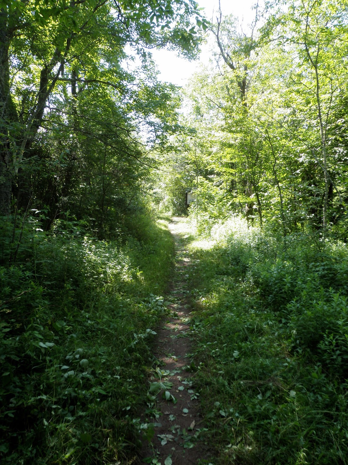
It was early, so I also did a short hike to Jimmy Creek falls. Didn't have to drive anywhere. Just crossed the road and followed creek upstream. I started along on the west side of the creek. After a few minutes, I crossed and picked up a path on the other side. I followed the path most of the way to the falls. I lost it at one point, but it was easy enough to just follow the creek. There were a couple guys at the falls hanging out and fishing. Not much water flowing, but still nice to see the waterfall. A nice summer day for some hiking.

Round-trip Distance: 1.5 mi
Elevation Change: 360 ft
Finch

Saturday, August 01, 2015

Holt Preserve

Went for a short walk this morning with Benny at the Holt Preserve (Copeland Hill). Parked at the lower trailhead. Climbed the yellow Ravine trail and then did a short loop using the green trail. About 1.5 miles distance.

In other news, Benny picked up a tick based infection (anaplasmosis). It was found on a routine blood test at the vet. He just has to take a course of antibiotics, but is otherwise fine.


Sunday, July 26, 2015

Rensselaer Tech Park

Went for a short walk this morning at Rensselaer Tech Park in North Greenbush with Benny. Did the yellow loop trail that is behind the WMHT building (local PBS TV station). Had a light rainstorm last night and there was murky water flowing down the creeks. About 1 mile round-trip.
Rensselaer Tech Park

Saturday, July 25, 2015

Hannacroix Ravine

Went for an easy hike this morning with Benny at Hannacroix Ravine Preserve in East Berne. Walked the orange loop trail - about 2.3 miles. Pictured is Benny on the "sandstone highway".


Thursday, July 23, 2015

Trout Lake mountain

Did some exploring in the Southern Adirondacks today. Parked at a pull-off on Route 10 - just under a mile north of where it crosses the West Branch Sacandaga river. After some searching, I found the start of the unmarked foot path that leads to Chub Lake. There was a small campsite here. I continued on the path that goes around the east side of the lake and then heads north. Crossed two small creeks near a beaver meadow. The trail split and I followed the left branch that leads toward the lower cliffs on Sherman mountain (dubbed McMartin). Shortly after, I lost the path. The woods were open and I would have only continued on for another 1/4 mile anyway. So, I just started my bushwhack early up to Trout Lake mountain. It was easy going all the way to the summit. Dropped down west to the cliffs. The best viewpoint were from some ledges about 100 feet below and SW of the top. From there was a 180 degree view to the west. A nice spot to take a quick break before heading down. I wasn't able to find the path again until I reached the creek crossings. Even then, you don't see the path until you are practically on it. I backtracked to the split near Chub Lake mountain that leads to the cliffs on Chub Lake mountain (dubbed Lost T). I took the path to the top of the cliffs. There were some views to the NW above the trees. From there it was a short climb to the summit. Came back down and checked the cliffs from below. Then, I headed back to the car.

Summit Elevation: Trout Lake mountain 2228 ft, Chub Lake mountain 2111
Round-trip Distance: 5.0 mi
Elevation Change: 1400 ft
Trout Lake

Wednesday, July 22, 2015

High Point

Went for a short stroll this evening near Thacher Park. Walked to High Point from the trailhead on Stage Coach road. I let Benny off the leash and he did well - except on the way back, when he inexplicably started running. Maybe he thought we were playing "tag". I caught up to him though. After that, he was back on the leash. About 2 miles round trip.


Saturday, July 18, 2015

Kinderhook Creek

Went for a short walk this morning with Benny at a relatively new spot in Rensselaer County - Kinderhook Creek Preserve. The trailhead is on Martha Hicks Road in East Nassau. Didn't have a map of the trails - so basically just did a clockwise loop using some of the marked trails - white, red and yellow. Easy walking on mostly wood roads with some small hills. About 1.3 miles roundtrip.
Kinderhook Creek

Thursday, July 16, 2015

Knob Lock

Climbed a trail-less peak in Northern Adirondacks today - Knob Lock mountain (Elizabethtown No. 1). Parked at the Owls Head Lookout/Giant mountain trailhead on Route 9N. Followed the trail for about 3/4 mile, then headed off trail and followed the eastern ridge of Knob Lock mountain. There were many open rock areas interspersed along the way. It got thick closer to the top, but eventually I made it. There were great views in almost all directions. I headed back down northeast and then north. It was also thick in this direction until I got further down the mountain. Eventually I reached the highway which I followed back to the car. Nice sunny day for hiking.

Summit Elevation: Knob Lock 3192 ft
Round-trip Distance: 6.0 mi
Elevation Change: 2100 ft
Knob Lock

Wednesday, July 15, 2015

Limestone Rise

Went for a short stroll this evening with Benny at the Limestone Rise Preserve out near Knox (south of Altamont). Parked on Nash road and started out on the entrance trail. Crossed Route 146 and followed the loop trail in the second half of the preserve. There were many fissures in the limestone rock. Walked about 1.3 miles round-trip. It was nice to have some cool weather after a string of hot, humid days.
Limestone Rise

Sunday, July 12, 2015

Levine

Went for an easy walk early this morning at the Levine Preserve in Saratoga County. Did a clockwise loop around the perimeter using the orange and green loop trails. Benny and I both enjoyed the trails that were soft underfoot. A bit over 2 miles of trekking.
Levine

Saturday, July 11, 2015

Trail Work

Went out this morning and did some maintenance on the escarpment trail in the Catskill mountains (my section is from NY Route 23 trailhead to the lean-to). Didn't seem as bad as last year. Used mainly the weed whip on this outing. Saw the usual assortment of hikers, trail runners, backpackers, mountain bikers and dogs. Pictured is one of the worst sections of trail in terms of growth (after I finished clipping) - not far from the road. About a 2.4 mile round-trip walk today.
.

Friday, July 10, 2015

Freedom

Went for a short walk on a pleasant evening at Thacher Park with Benny. Parked at Paint mine lot and did a loop on the red trail. I let Benny off the leash the majority of the time, and he did pretty well - especially for a beagle. Only had to put him back on leash when we encountered some other dogs. Pictured below is Benny enjoying some new freedom. Walked around 1.5 miles.

Friday, July 03, 2015

Benson Hills

Went for a hike in the Southern Adirondacks today. Checked out a future section of the Northville Placid trail. Parked at a new trailhead on Gifford Valley road. The trail begins with a moderate climb through open woods with many switchbacks. There is periodic flagging, but it is otherwise unmarked. The treadway seems well defined for a relatively new trail. After about 2 miles, I reached Mud Pond. The trail turns left onto an old woods road. It climbs for a short bit before dropping again. At this point, I left the trail and headed up the hill to the north (un-named, but I will call it Mud Pond Hill). There were several rocky areas with views to the south. I continued down the west side of the hill into the notch. There was a small creek to cross. Then, I climbed the next hill to the west (un-named, but I will call it West Stony Creek mountain). As I got further up, there were more open areas with raspberries and other scratchy plants. Good to be wearing long pants. Got to a viewpoint looking east back toward Mud Pond hill. Kept climbing and soon reached the top which didn't have any views. I dropped down the west side to some open rock areas with nices views to the West. I went down the south side of the mountain until I reached the trail again. Then, I followed the trail back to the car. Nice day out with few bugs.

Summit Elevation: Mud Pond Hill 1852 ft, West Stony Creek mountain 1993
Round-trip Distance: 7.5 mi
Elevation Change: 1900 ft
Benson Hills

Friday, June 26, 2015

Bear Swamp

Went to Bear Swamp Preserve near Westerlo with Benny this evening. Parked at the trailhead on Bear Swamp Road (CR 404). We followed the Perimeter trail clockwise around the swamp. The last 1/4 of the loop was flooded by a beaver dam. We had to cut back to the road and follow that back to the car. Next, we went across the road and followed the Little Bear trail. It was a short walk to a memorial and another wooded swamp. Supposedly, the rhododendrons here (Rhododenron maximum) bloom in late June/early July, but I didn't see anything blooming. Had a nice, leisurely stroll though. Walked about 2.5 miles altogether. Unfortunately, we both picked up a couple ticks.
Bear Swamp

Wednesday, June 24, 2015

Robert Woodruff

On Wednesday, I stopped on the drive back home at the Robert Woodruff Outdoor Learning Center in Van Hornesville. There was a short guided nature trail that lead you to an old saw  mill site, limestone caves and some waterfalls and cascades. A neat spot to visit in the middle of nowhere. Walked about 1.25 miles on another lovely day.

Robert Woodruff

Tuesday, June 23, 2015

Guppy Falls

On Sunday, I walked the Charlie Major trail in Skaneateles with my Dad, sister and beagle Benny. There was a strong flow in the creek that flows out of the lake. Unfortunately, I didn't bring my camera. About a 1.6 mile walk round trip.

On Tuesday, I went back to Skaneateles with my sister and we visited Guppy Falls in the Skaneateles Conservation area. From the trailhead on Gully road, we did a clockwise loop on the yellow and red trails. The view of the falls was obscured by leaves, but still nice. We walked about 1.5 miles today. Could have walked more, but the mosquitoes were pretty bad ...also, Benny was pooped out from all his adventures.
Guppy Falls

Monday, June 22, 2015

Chimney Bluffs

While visiting family in Central New York this week, I did some easy walks and hikes. On Monday, I went to Chimney Bluffs State Park near Sodus Point on Lake Ontario with my sister (and beagle Benny). We did a counter-clockwise loop on the East-West, Drumlin and Bluff trails. The natural sand formations were neat to see. Surprisingly, neither of us had been here before. On the drive back, we stopped at Wolcott Falls Park. A short trail lead down to the base of the 50 foot tall waterfall. Walked around 3 miles altogether on a beautiful day.

Chimney Bluffs

Saturday, June 20, 2015

Third Brother

Went for a short bushwhack hike in the Eastern Adirondacks this morning. I climbed the Third Brother near Brant Lake. I had already climbed the first two on a previous trip. I parked on Route 8 near the culvert for Spuytenduivel brook. I entered the woods and followed along the left bank of the brook. There was a path of sorts (marked with faded white paint). The brook had decent flow and there were several small cascades. I left the brook and followed a branch that heads up to the col between the Second and Third Brother. But first I had to get around a small beaver pond near the start of it. After going around the west side of the pond, I headed up northeast toward the peak. It was a moderately steep climb most of the way, but there were no terribly tricky parts. The woods were also very open and I started to get views about half up the mountain. I soon reached the top and explored around for more views. I headed down west and picked up the Camp Reed path which I followed to the col. Then, I dropped down the south side of the ridge and picked up the branch brook. Went around the beaver pond further to the west over a little knob (elev. 1020). before reaching the main brook. Felt nice to soak my feet in the cool waters of the brook. Had lovely weather for a quick hike. Only a few mosquitoes were out and biting.

Summit Elevation: Third Brother 2003 ft
Round-trip Distance: 3.5 mi
Elevation Change: 1140 ft
Third Brother

Friday, June 19, 2015

Christman

Went for an easy stroll at Christman Sanctuary this evening with Benny. Did a loop on the blue trail and the yellow spur trail that leads to the main falls. Benny got a lot of attention from some teen girls at the lean-to. Walked about a mile.
Christman

Sunday, June 14, 2015

I'm OK

Went for a short hike today to OK Slip Falls in the Central Adirondacks. Parked in the lot on Route 28 between North Creek and Indian Lake. Had to walk up the road a short distance to the trailhead. The trail was wet and muddy in spots, but overall nice. There were a lot of little ups and downs though. At one point, the trail crosses the dirt road that leads to Northern Frontier camp. Then, it was about another mile to go. I reached the first viewpoint of the falls and the second viewpoint shortly after - it had a more screened in view. The falls are nice, but you are so far away up on the opposite wall of the valley to truly enjoy them. I opted to turn back instead of following the trail that continues down to the Hudson River. Saw lots of other hikers out on this relatively new (to the general public) and popular trail. About 6.0 miles roundtrip on a warm, sunny day.
OK Slip

Saturday, June 13, 2015

Hannacroix

Visited Hannacroix Creek Preserve this morning with Benny. Wanted to check out a waterfall after the heavy rainstorm last night. We followed the trail to the falls (including the blue trail) and also did a loop on the red trail. Walked around 2 miles. Trails were damp and there were some mosquitoes out, but still a pleasant stroll.
Hannacroix Creek

Wednesday, June 10, 2015

Thacher

Went for a short walk this evening with Benny on the Indian Ladder trail at Thacher Park. About a mile walk.


Sunday, June 07, 2015

Rensselaerville

Went for an easy walk this afternoon with Benny at the Rensselaerville State Forest. Parked near the start of the CCC road. Did a short clockwise loop on the truck trail and returned via Cheese Hill road. Also, took a side trip to an unnamed pond that was accessed via another truck trail. On the drive back, stopped at the Huyck Preserve for a short trek to the waterfall. Walked about 2.5 miles on another beautiful sunny day.
Rensselaerville

Saturday, June 06, 2015

Dead Horse

Did some exploring in the Southern Adirondacks today. Drove north on Powley-Piseco road (a long gravel road) until just before the bridge/culvert over Brayhouse brook. I parked there and then followed the unmarked woods road west (leads to Brayhouse Gore). Passed a couple of hunting camps on the way. I reached Bowers Vly and then headed north off-trail up to the eastern cliffs/ledges on Dead Horse mountain. The woods were open and mostly deciduous, but there was a lot of hobble bush to make it more difficult. Reached the base of the cliffs and then found a steep slope to climb up. One ledge in particular had a nice open view to the east and south. I continued west to find the high point and then dropped down to the woods road and back out. I also made a short side trip to the Potholers (cascades) on East Canada Creek (about a 5 minute walk).

Summit Elevation: Dead Horse mountain 2412 ft
Round-trip Distance: 6.5 mi
Elevation Change: 1000 ft

Afterwards, I drove north for about five miles. I parked and then climbed West Notch mountain. Went up its north side and the followed the ridge to the high point. I tried, but didn't find any decent views, but there were open areas and some views through the trees.

Summit Elevation: West Notch mountain 2344 ft
Round-trip Distance: 2.0 mi
Elevation Change: 550 ft
Dead Horse


Wednesday, June 03, 2015

Pisgah

Did some exploring in the Central Adirondacks today. From Lake Abanakee, drove Chain Lakes Road to the former Gooley Clubhouse. Parked in the small lot there. The gate was closed at this point, so I hoofed it along the Gooley club road for about a mile. Then I headed north off trail and reached Big Pisgah mountain after a short climb. Woods were fairly open, and there no ledges or cliffs to contend with. I explored around the burned over areas that provided views to the south and west.  After tagging the true summit, I headed over to Little Pisgah which had similar views. I returned back to the Gooley club road using one of the logging roads that I had crossed. It lead me right to the parking area used by hunters in the fall. I also checked out Clear Pond via the marked trail (yellow DEC markers in addition to the original markers), before returning to the car.

Summit Elevation: Big Pisgah 2211 ft, Little Pisgah 2200 ft
Round-trip Distance: 6.0 mi
Elevation Change: 1100 ft
Pisgah


I drove a little bit back down the road and parked at a roadside campsite. I checked out some low cliffs that are just 1/4 mile west of the road. Had decent views for the little amount of climbing involved.

Round-trip Distance: 1.5 mi
Elevation Change: 400 ft


Sunday, May 31, 2015

Wolf Hollow

What a difference a day makes ... It was about 25 degrees cooler today than Saturday! After a light rain in the morning, I went for a short walk with Benny in the afternoon near Glenville. We walked an abandoned town road through Wolf Hollow. This narrow road parallels Hoffman Hill road and runs through a gorge. It was closed after Hurricane Irene due to flood damage. It is now part of the future Long Path extension and has aqua green markers along the route. The road is still a public thoroughfare, but much of the adjacent land is posted. We walked about 2.2 miles round-trip today with 275 feet of climbing under grey skies.
Wolf Hollow

Saturday, May 30, 2015

Dyken Pond

Got out early today to try and beat the heat. Went for a short walk with Benny at Dyken Pond Center in Rensselaer County. Parked at the main visitor center. Did a clockwise loop using the Abbt Farm (purple), Old Road (purple), Long (white), Otter Creek (yellow/white), and  Shoreline (light blue) trails. Pretty much had the woods to ourselves on this lovely morning. Walked around 2.5 miles.

Dyken Pond

Friday, May 29, 2015

Harris Hill

Went for a short bushwhack hike in the Northeastern Adirondacks today. I climbed Harris Hill in the Hammond Pond Wild Forest. Parked on Ensign Pond Road in a dirt pull-off on north side of road near a road-side memorial. The beginning of the hike was a little tough - had to get around a steep mini knob and through a logged area with some blowdown. Then, I started climbing up the SW ridge of the mountain to the first false peak. It was relatively easy going with mostly open woods and no cliffs or steep parts. Quickly reached the top and then followed the ridge over the second false peak and then the true peak of Harris Hill. There were nice views along the way to the west. Lots of open areas with blueberries on this peak. Had a warm, sunny day for a quick trek in the woods. Luckily, bugs were not too bad.

Summit Elevation:  Harris Hill 2211 ft
Round-trip Distance: 3.5 mi
Elevation Change: 1350 ft
Harris Hill

Monday, May 25, 2015

Papscanee Preserve

Recovering from a head cold, so just did an easy walk this morning with Benny at Papscanee Island Nature Preserve in East Greenbush. Parked at the Staats Island Road trailhead. Followed the Red and Blue trails and then the white trail until the farmer's field before turning around. Lots of birds singing and saw a deer prancing around the woods. Walked almost 2 miles under cloudy skies.


Papscanee

Sunday, May 17, 2015

Prosser Hollow

Went for a short hike early this morning in Rensselaer County. Climbed up to Taconic ridge using the Lower Prosser Hollow trail. This is an old road that is now a foot trail. The bottom part was a bit muddy and rutted from ATVs. Further up, the trail was dryer and in better shape. After an almost continuous climb, I reached the Taconic Crest trail. I turned left and headed north. Passed a nice cut view looking east into Vermont. Continued on as the TCT descended. Soon I reached the unmarked Upper Prosser Hollow trail. I turned left and followed the eroded trail downhill. It became more muddy and overgrown toward the bottom with prickers. I reached a meadow/field and pretty much lost the trail at this point - so, I just headed south. I soon reached the Lower Prosser trail again, not far from the car. Returned a bit scratched up, but no worse for wear.

Round-trip Distance: 3.0 mi
Elevation Change: 1000 ft

Prosser Hollow

Friday, May 15, 2015

Cherry Plain

Left work a little early and did an easy walk with Benny at Cherry Plain State Park/Capital District Wildlife Management Area (WMA). Parked near the campground/park entrance (which was closed). Started out on the blue-marked waterfalls trail. Then took a short red spur trail to the old mill site and some small waterfalls on the Black River. Returned to the blue trail. At one point, the trail crossed the river, but I continued on the old road for a while until it petered out. Then, I backtracked to the crossing and continued on the blue trail on the other side of the river. It eventually lead back to a trailhead on Jiggs Highway. We then followed Miller road back to the car.

Next, we took the Charcoal Trail which starts at the SW corner of the beach parking area. Followed it uphill to a spur trail that dead ended at a charcoal site. Back on the charcoal trail, continued for a while to where it leveled off in a pine plantation. Didn't see anything of note except some rusty barrels.

A very pleasant evening for a stroll. Some mosquitoes were out, but a dash of DEET took care of them. Walked about 3 miles altogether.

Cherry Plain SP

Thursday, May 14, 2015

Pine Hill

Went for an off-trail adventure in the Adirondacks today to climb another forlorn mountain. Drove on the gravel Charlie Hollow road (off Charlie Hill road) until the last house/camp. I parked here and then continued walking west on the dirt road (also a snowmobile trail). When I reached State land boundary, I left the road and headed south and down to Alder brook. Rock hopped across the creek and then hiked up the north side of Pine Hill. I reached a band of cliffs around elev. 1400. After a steep climb, made it to the top of them and had some nice early views to the north and west. Continued on up and reached a clearing with a view to the east. Eventually, I reached the false summit (elev. 2076). From here, I travelled east to the true peak. There were survey bolts/anchors at the rocky top, so this must have been a survey station back in the day. I ventured around the east and southern sides just below the top, to check out all the views from the clearings. The black flies at this point were swarming, but not biting. Had a very pleasant day for my trek in the woods - lots of sun and nice breeze at times.

Summit Elevation: Pine Hill 2187 ft
Round-trip Distance: 6.0 mi
Elevation Change: 1600 ft
Pine Hill

Wednesday, May 13, 2015

Happy birthday!

Hard to believe, but this blog turns ten years old this month!


Saturday, May 09, 2015

Amy's Park

Went on a short hike this morning with Benny near Lake George. We visited Amy's Park just north of Bolton Landing. Parked on Trout Falls road. Took the red trail up to the lookout on the shoulder of High Nopit. Followed the yellow trail back down and then the road back to the car. Also, explored the area around the beaver ponds a bit. A warm, breezy day for Benny's Adirondack adventure. Some bugs out, but not too terrible (yet!). Walked about 2 miles altogether with 450 feet of climbing.
Amys Park

Thursday, May 07, 2015

Cattle mountain

Climbed another obscure peak in the Southern Adirondacks. From looking at satellite images, I thought that Cattle mountain might have some views from its southern false peak. So, I went out today to check it out. Drove down Pumpkin Hollow road off Route 30. Parked near Willis Lake, since the road was closed beyond this point. I walked the remaining portion of the dirt road - about 1.5 miles. It was rutted in a few places and had one blowdown, but was not too bad. Reached the summer parking area, and the bridge over Doig creek. After crossing it, I followed a hunters path that lead north. It was unmarked, but easy to follow. After a bit, it crossed Doig creek where the creek turned east, and continued north along the western base of Cattle mountain. After almost a mile, it petered out. I checked out a beaver meadow just west of the path. I was hoping to spot the open areas on Cattle mountain. From this angle, it didn't looking promising, but I persevered. Climbed up the west side of the peak to the southern false summit. I reached the open areas and found nice views to west and south. I continued north along the ridge to the true peak and a bit beyond before returning. Black flies are starting to making an appearance, but not annoying yet. Quite warm and sunny day. Almost felt like going for a swim in Willis Lake if the water was a bit warmer.

Summit Elevation: Cattle 2129 ft
Round-trip Distance: 6.0 mi
Elevation Change: 1200 ft
Cattle mountain

Saturday, May 02, 2015

Barton High Cliffs

Went for another hike in the Adirondacks today. Visited Barton High Cliffs in the Pharaoh Lake Wilderness. Parked on NY Route 8 at a scenic pull-off. Walked five minutes back down the road to a small creek (a branch of Swede Pond brook). Started my bushwhack here, following the creek uphill to a level area. It was a bit swampy here with a bunch of blowdown. I continued north along the east side of Brace Hill. Eventually I veered off and started climbing the unnamed hill (elev. 1910) that the cliffs are on. I got a little too far up and had to climb back down to the cliffs. It was an easy traverse along the tops of the cliffs to the east end. That were lots of views along the way. Dropped down the east side into the valley a bit too far. Had to climb back up to the area below the cliffs. I climbed partway up the hill to the north and traversed across. There were nice views from open areas of the cliffs overhead. At one point, I dropped down into the notch to check out the boulder field. There was still snow here and it was significantly cooler. It was too difficult try to make my way through the boulders, so I went around them to the north. Eventually I reached a branch of Spuytenduivel brook. I followed it uphill, and then back down the other side to Route 8 again. Warm, sunny day for a little off-trail adventure.

Round-trip Distance: 5.5 mi
Elevation Change: 1300 ft
Barton High Cliffs