Sunday, October 28, 2007

Vly not

Howie and I did a short hike in the western Catskills today. We climbed Vly mountain from the north side. Parked near the last house on CR 3 (with the white porcelain toilet planter ... nice touch) where the pavement ends. Then, we walked up the steep, gravel road to the ridge where there was a hunting shack (nobody there). Opposite the shack a path begins that follows the state land boundary and leads all the way to the summit. I lost it in the middle section, but the woods were open enough to allow for easy passge. Found the path again and then reached the top. I signed the notebook in the canister and had a snack. Looked for some views but found only partial views through the trees. Headed back down to the car.

Summit Elevation: Vly 3529 ft
Round-trip Distance: 4.5 mi
Elevation Change: 1860 ft

Vly

Friday, October 26, 2007

Signs, signs, everywhere ....

The second hike was at the OSI nature preserve adjacent to Thacher Park. Parked at the end of Ryan road. There was a couple there put up new hiking signs at the trailhead. I followed the yellow trail down to the Long Path (aqua paint markers) which I took over to the Hails Cave picnic area. One of the park workers stopped by in his truck and said the park closed in an hour. I had a quick snack and headed back to the car as it started to rain lightly. This was around a 2.5 mile trip.

OSI Preserve

New path

I left work a little early this afternoon, and did a couple short hikes with Howie near Thacher Park. The first was up a newly re-routed section of the Long Path to Roemers High Point. Parked on Elm Drive and walked up the well-marked trail to the view point. It was about a 1.75 mile trip.

High point

Sunday, October 21, 2007

Beebe

The second hike was up Beebe Hill near Austerlitz. At the top was a fire tower which I climbed.

Summit Elevation: Beebe Hill 1760 ft
Round-trip Distance: 2.0 mi
Elevation Change: 300 ft

Technicolor

Howie and I did a couple of hikes today. The first adventure was a climb up Alander mountain. We started out on the Southern Taconic trail from the NY parking lot on Route 344. Got to the first view point and took a break. It was quite warm out (70s) so I converted my pants to shorts. Continued along the ridge in bright sunshine all the way to the summit. On the return, I took the blue side trail over to Bash Bish falls. It was a very popular spot today.

Summit Elevation: Alander 2250 ft
Round-trip Distance: 7.0 mi
Elevation Change: 1500 ft

Sunday, October 14, 2007

Indian Head

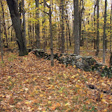
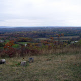
Howie and I did a short hike in the Catskills today. We did a loop over Indian Head mountain from Prediger Road. When we started out, it was sunny with some clouds. As we approached the view points, the sky was completely grey. On the drive back, the sun was out again. I think the sun is conspiring against me. We also checked out Plattekill falls. A nice cool day for ambling. Fall colors seem to be past peak.

Summit Elevation: Indian Head 3573 ft
Round-trip Distance: 6.7 mi
Elevation Change: 1600 ft

Monday, October 08, 2007

Suburban escape

Our last hike was in the Ellanor C. Lawrence Park. This was an easy walk through a mostly wooded area in the middle of sprawling suburbia. Highlights included seeing a deer, squirrels, chipmunks, lots of birds, a pond and a small garden with tobacco.

Sunday, October 07, 2007

Bahhhhh

After a scenic train ride on Saturday, our next hike was on Sunday to Great Falls. We did a trek along the Billy Goat trail (section A) which was only 1.7 miles long. It seemed much longer since the the trail was surprisingly rugged. Total distance covered was around 4 miles.

Friday, October 05, 2007

Going underground

Our next outing was to Lurary caverns. We went on a guided tour which was about a mile walk underground. Even got to hear an organ that used stalactites to produce the notes.

Da bears

I went down to visit my sister Anne in Virginia this weekend. We did some hiking and other activities. Our first outing on Friday was to Shenandoah National Park. We hiked down the White Oak Canyon trail to the first (higher) cascading falls, and then a little beyond the viewing ledge before turning around. There were some early Fall colors. We thought the highlight of the trip would be seeing a large snake. But, that paled in comparison to seeing three black bears (a momma and her cubs). Covered at least 5 miles.